After Fran, cold temps lock snow and ice in place
Published 10:30 am Monday, January 26, 2026
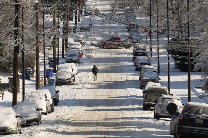


Southcentral Kentucky will be dealing with the fallout from Winter Storm Fran for the next several days, as subfreezing temperatures will basically set the snow and ice that blanketed the area over the weekend in place.
Based on collected reports, 3.5 inches of snow was measured in Bowling Green as of 7 a.m. Monday, according to the National Weather Service, and an extreme cold warning from the NWS was to remain in effect overnight for the region.
The ice that has collected in between snowfalls, however, has had the effect of packing the snow on the ground tightly in place while weighing down branches and power lines.
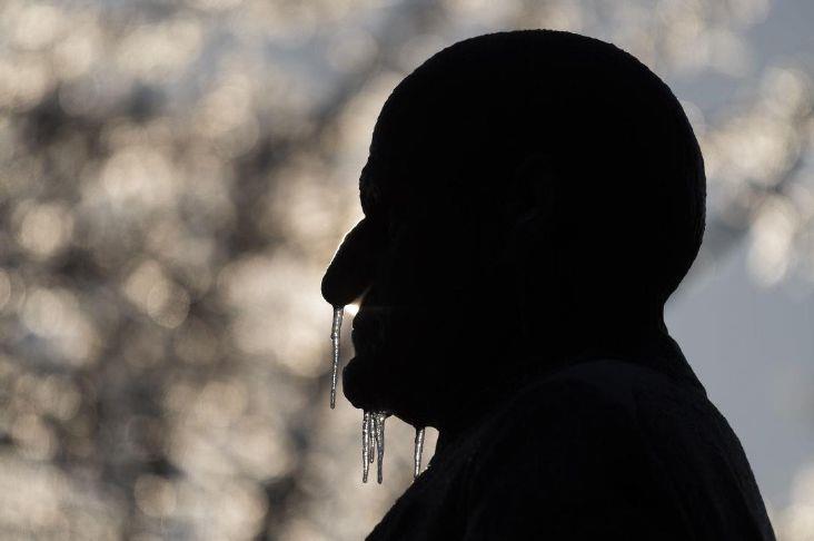
The forecast for Bowling Green is not expected to rise above the freezing point this week, with nightly low temperatures dipping into the single digits and threatening to venture below zero.
“Tomorrow should be quote-unquote the warmest day with real-time temperatures getting up to near 30,” said meteorologist Landon Hampton of WXorNotBG about Tuesday’s forecast. “The UV rays from the sun will assist with road crews and that should really improve conditions on the primary routes, but our wind chill values are going to stay extremely cold and we’ll be watching for the possibility of scattered light snow showers in the Thursday-Friday time frame.”
While as many as 2,500 outages affecting Warren RECC customers were reported Sunday, power was fully restored Monday morning and Warren RECC workers were aiding restoration efforts for Tri-County Electric Membership Corporation, which has members in Allen, Barren, Warren and several other Kentucky and Tennessee counties.
As of Monday morning, 7,536 outages were reported in Allen County and 3,218 outages were in Barren County, according to poweroutage.us.
In a video update on its Facebook page, Tri-County Electric CEO Glenn Hale said that power restoration will be happening in phases and that outages may last longer than expected due to the extent of damage.
“This storm of historic proportions has caused widespread damage across our system,” Hale said. “This damage includes downed power lines, broken poles and tree damage from ice accumulation. Icy roads and hazardous conditions are slowing access for our crews to begin repairs.”
The Allen County Sheriff’s Office reported Monday on its Facebook page that the business office would be closed Tuesday, and noted that certain roads in the county were impassable, urging people to stay home.
Wes Watt, spokesman for the Kentucky Department of Transportation District 3, said road crews have been helped by the sunlight Monday in their efforts to clear the roads in the area, but continued cold weather will present challenges throughout the week.
“With the temperatures getting as cold as they are Monday night, any road that still has water on it is going to refreeze and create icy conditions that may not have been there Monday afternoon,” Watt said. “We are certainly going to see this stick around for multiple days this week, particularly in our more rural areas.”
For conditions of extreme cold, the NWS urges people to take precautions that include dressing in layers, adjusting your travel to weather conditions, making frequent checks on older and vulnerable friends, family and neighbors and ensuring portable heaters are used correctly, with generators to be used outdoors only and kept at least 20 feet away from doors, windows and garages to avoid carbon monoxide poisoning.


Best of Best Winners