Wracked by flooding, area braces for snow
Published 12:58 pm Monday, February 17, 2025
1 of 18
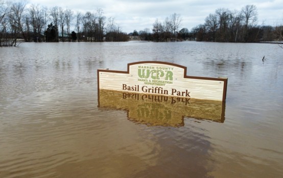
Flooded water covers the boat ramp at Basil Griffin Park on Monday, Feb. 17, 2025, after weekend storms of torrential rain caused flooding around several areas of southcentral Kentucky.
GRACE MCDOWELL / DAILY NEWS
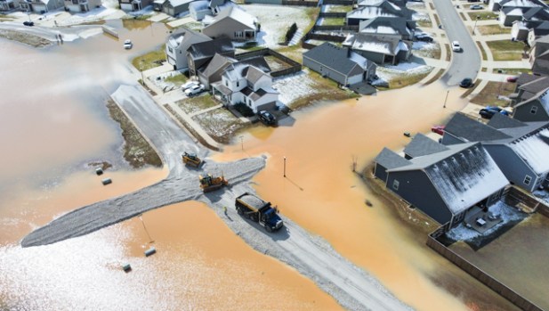
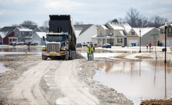
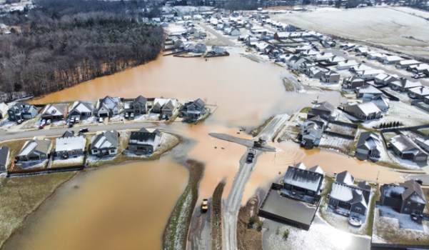
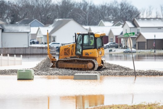
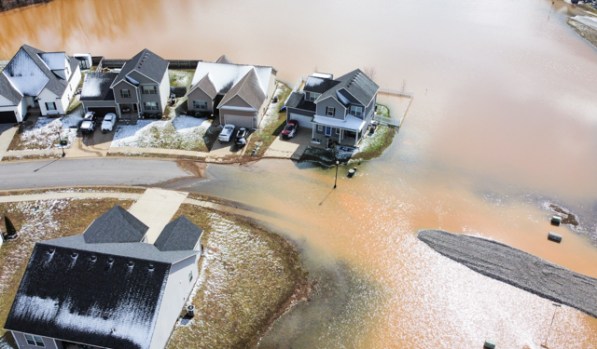
Road crews move truck loads of stones into the Weather Stone subdivision off Russellville Road to build up the neighborhood streets to allow access for homeowners and emergency crews on Monday, Feb. 17, 2025, after weekend storms of torrential rain caused flooding around several areas of southcentral Kentucky.
GRACE MCDOWELL / DAILY NEWS
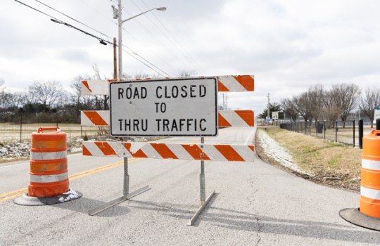
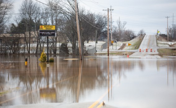
Signs and traffic cones block Three Springs Road due to flooding across the roadway by Basil Griffin Park on Monday, Feb. 17, 2025, after weekend storms of torrential rain caused flooding around several areas of southcentral Kentucky.
GRACE MCDOWELL / DAILY NEWS
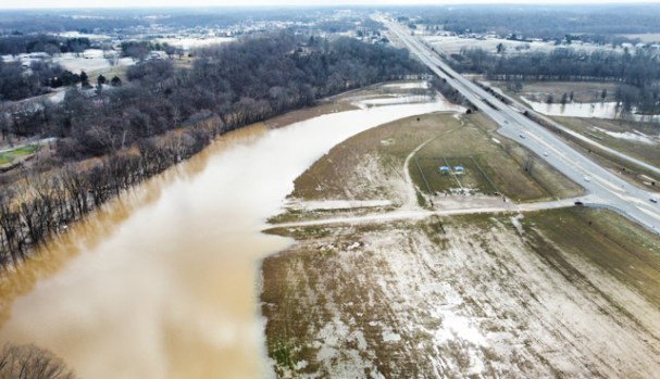
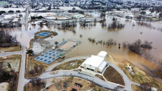
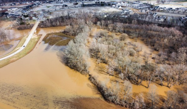
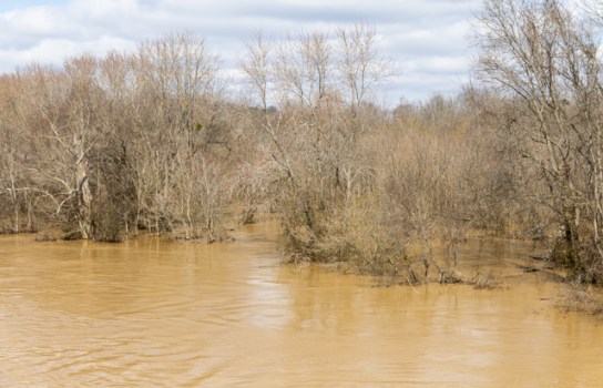
Flooded water begins to recede to the banks of Drakes Creek around Phil Moore Park on Monday, Feb. 17, 2025, after weekend storms of torrential rain caused flooding around several areas of southcentral Kentucky.
GRACE MCDOWELL / DAILY NEWS
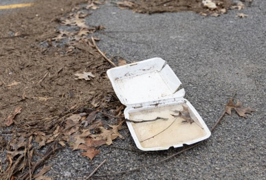
Mud, sticks and loose garbage are washed up and frozen in the parking lot of Basil Griffin Park on Monday, Feb. 17, 2025, as the waters begin to recede and freeze after weekend storms of torrential rain caused flooding around several areas of southcentral Kentucky and the region braces for winter storms Monday night into Tuesday.
GRACE MCDOWELL / DAILY NEWS
Flooded water begins to recede from the road-blocked Three Springs Road by Basil Griffin Park on Monday, Feb. 17, 2025, after weekend storms of torrential rain caused flooding around several areas of southcentral Kentucky.
GRACE MCDOWELL / DAILY NEWS
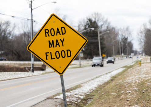
Vehicles travel along Three Springs Road down the line from where Kentucky Transportation Cabinet District 3 officials have blocked off the road due to flooding across the roadway by Basil Griffin Park on Monday, Feb. 17, 2025, after weekend storms of torrential rain caused flooding around several areas of southcentral Kentucky.
GRACE MCDOWELL / DAILY NEWS
Flooded waters overflow the lake at Basil Griffin Park onto Three Springs Road and beyond on Monday, Feb. 17, 2025, after weekend storms of torrential rain caused flooding around several areas of southcentral Kentucky.
GRACE MCDOWELL / DAILY NEWS
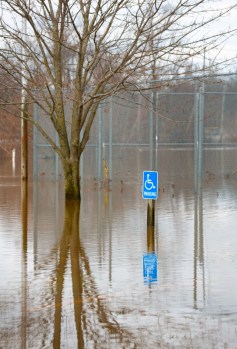
Flooded water covers the parking lot of Basil Griffin Park on Monday, Feb. 17, 2025, after weekend storms of torrential rain caused flooding around several areas of southcentral Kentucky.
GRACE MCDOWELL / DAILY NEWS
Flooded waters fill the Warren County Inline Hockey rink at Basil Griffin Park on Monday, Feb. 17, 2025, after weekend storms of torrential rain caused flooding around several areas of southcentral Kentucky.
GRACE MCDOWELL / DAILY NEWS
Flooded water begins to recede to the banks of Drakes Creek around Phil Moore Park on Monday, Feb. 17, 2025, after weekend storms of torrential rain caused flooding around several areas of southcentral Kentucky.
GRACE MCDOWELL / DAILY NEWS
Flooded water begins to recede to the banks of Drakes Creek around Phil Moore Park on Monday, Feb. 17, 2025, after weekend storms of torrential rain caused flooding around several areas of southcentral Kentucky.
GRACE MCDOWELL / DAILY NEWS
Road crews move truck loads of stones into the Weather Stone subdivision off Russellville Road to build up the neighborhood streets to allow access for homeowners and emergency crews on Monday, Feb. 17, 2025, after weekend storms of torrential rain caused flooding around several areas of southcentral Kentucky.
GRACE MCDOWELL / DAILY NEWS
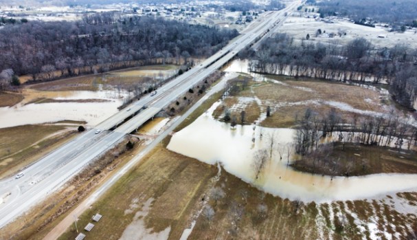
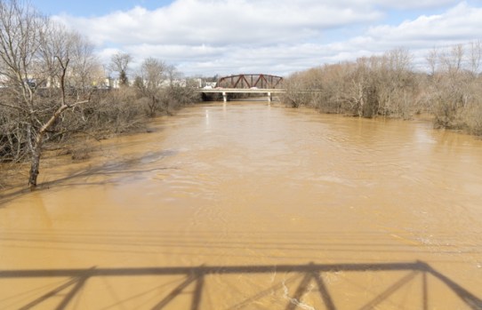
Barren River overflows its banks on Monday, Feb. 17, 2025, after weekend storms of torrential rain caused flooding around several areas of southcentral Kentucky.
GRACE MCDOWELL / DAILY NEWS
Barren River overflows its banks on Monday, Feb. 17, 2025, after weekend storms of torrential rain caused flooding around several areas of southcentral Kentucky.
GRACE MCDOWELL / DAILY NEWS
Several road closures remain in effect in the area due to flooding caused by a torrential weekend rain, and southcentral Kentucky could find itself under a blanket of snow in the middle of this week.
A total of 11 deaths across the state have been confirmed as a result of the flooding, including those of a mother and her 7-year-old child in Hart County on Saturday night after the vehicle they were in on Campground Road in Bonnieville was swept away near Bacon Creek.
Hart County Coroner Tony Roberts said that emergency workers recovered the child’s body, and began work Sunday to recover the body of the mother as well as the submerged vehicle.
Kentucky Transportation Cabinet District 3 listed numerous road closures of state highways in the area as of 5 a.m. Monday morning due to flooding, including nine closures in Warren County, eight in Logan County and 13 in Simpson County.
KYTC encouraged motorists to not drive around or move barricades on flooded roads.
“There have been multiple reports of this being done, some resulting in water rescues,” KYTC said in a news release. “Do not attempt to drive through possible high water.”
The transportation cabinet also warned about the possibility of icy spots forming on roads due to low temperatures.
A total of 19 county road closures were listed Monday morning by Warren County Government on its social media pages, and another 10 locations were marked with high water cones but deemed passable.
The rising floodwaters prompted a number of calls for rescue, including that of a person at Beech Bend Campground who climbed onto the roof of their camper after being trapped by flooding.
The Richardsville Volunteer Fire Department said it received a call at 8:47 a.m. Sunday to conduct a welfare check and water rescue at the campground, which is situated along Barren River.
Emergency workers launched a boat and rescued the person.
The fire department was assisted at the scene by the Warren County Sheriff’s Office and Warren County Emergency Management.
A team of six Bowling Green Fire Department firefighters was deployed Sunday morning to eastern Kentucky to aid in rescue efforts there.
A post on BGFD’s Facebook page said Sunday that the team of firefighters was staging at a fire station in Richmond and awaiting orders.
Flood warnings remain in effect throughout the area.
The National Weather Service issued a flood statement Sunday night that said Drakes Creek crested at 35.9 feet on Sunday and that Barren River in Bowling Green reached up to 39.1 feet on Sunday and was expected to rise to 39.2 feet Monday morning.
Flood stage for the Barren River in Bowling Green is at 28 feet, and the water levels reached this weekend approached a previous crest of 39.5 feet reported in 1978, according to information from the NWS.
Two-day rainfall totals for Saturday and Sunday were measured at anywhere between 4.88 and 6.42 inches at Kentucky Mesonet weather tracking sites in Warren, Simpson and Allen counties.
A light accumulation of snow on Sunday may be a preview of wintry weather to come for the area, which is under a winter storm watch from Tuesday evening through Wednesday evening.
The NWS said Monday morning that total snow accumulations in the affected area between two and six inches are possible.
Emergency agencies across the region were urging people to travel safely and make a plan for dealing with potential snowfall as well as continued flooding.
“Please gather your resources today and in the morning on Tuesday so you can be prepared to continue hunkering down for a day or two as we respond to the winter weather,” the Simpson County Department of Emergency Management said in a post Monday morning on its Facebook page.
In an update given Monday morning, Kentucky Gov. Andy Beshear said that Indiana and Tennessee National Guard members have joined Kentucky National Guard soldiers and airmen in an expanding response effort that has already brought in the assistance of various agencies from several neighboring states.
Two National Guard trucks were overcome by floodwaters in separate missions, according to the governor.
“It got very dangerous for one set of Guardsmen, but we are glad they are safe,” Beshear said. “Despite the challenge, our Guard members remain on the ground working side by side with our first responders.”


